You've arrived in Atlanta with a few hours to spare, opened a trail map, and discovered that the BeltLine isn't one perfectly continuous path. One direction leads toward Piedmont Park, another toward Krog Street Market, and the larger network reaches neighborhoods, parks, public art, restaurants, and future transit corridors across the city. The challenge isn't finding something to do. It's choosing a realistic route that matches your time, mobility, energy, and comfort level.
The Ultimate Atlanta BeltLine Guide for Visitors and Locals is designed as a practical field guide. You'll learn how the project developed, what the mileage figures mean, how the open segments differ, and how to plan a day by foot, bike, or transit. You'll also find a grounded look at nighttime logistics, accessibility, housing pressure, and the environmental responsibilities that come with a major urban redevelopment project.
Welcome to the Atlanta BeltLine
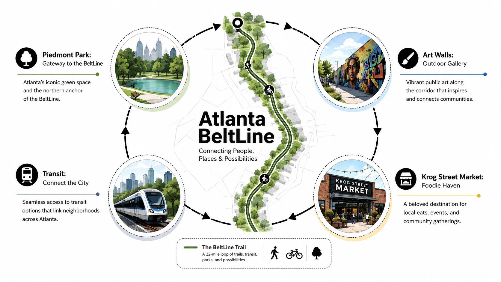
A first BeltLine outing often begins with an easy eastside plan. Start near Piedmont Park, follow the leafy Eastside Trail through Midtown and the Old Fourth Ward, pause for public art, and continue toward Inman Park and Krog Street Market. That route gives you a compact introduction to the corridor's most recognizable ingredients, parks, former rail infrastructure, restaurants, neighborhood streets, and a steady flow of walkers and cyclists.
The BeltLine is better understood as a citywide system than as a single path. Its planned framework combines a 22-mile loop, connector trails, public spaces, former freight rail corridors, and a future transit component. Some portions provide a continuous multi-use trail, while other connections still involve sidewalks, protected lanes, or short street transfers.
Start with one segment
Trying to experience the entire BeltLine in one visit usually creates a poor day. Instead, select a primary segment and build around nearby destinations.
- For a first visit: Choose the Eastside Trail, where Piedmont Park, the Old Fourth Ward, Inman Park, public art, and Krog Street Market create a dense sequence of stops.
- For more open space: Consider the Westside Trail, which offers a different pace and connects areas such as West End, Adair Park, and Southwest Atlanta.
- For neighborhood exploration: Use the Northeast or Northwest trails when you want a smaller-scale connection rather than the busiest visitor corridor.
- For local businesses: Leave time for restaurants, markets, galleries, and community destinations close to the path instead of treating the trail as a point-to-point race.
Trail conditions, construction activity, access points, event schedules, and transit service can change. Before leaving, check the official Atlanta BeltLine visitor information and choose a route with confirmed entry and exit points. If you're looking for additional Atlanta ideas before or after your trail outing, this Atlanta weekend guide can help you build a broader itinerary.
Practical rule: Treat the BeltLine as a collection of connected experiences. A successful day depends more on choosing the right segment than on covering the most ground.
How the BeltLine Went from Thesis to 33-Mile Network
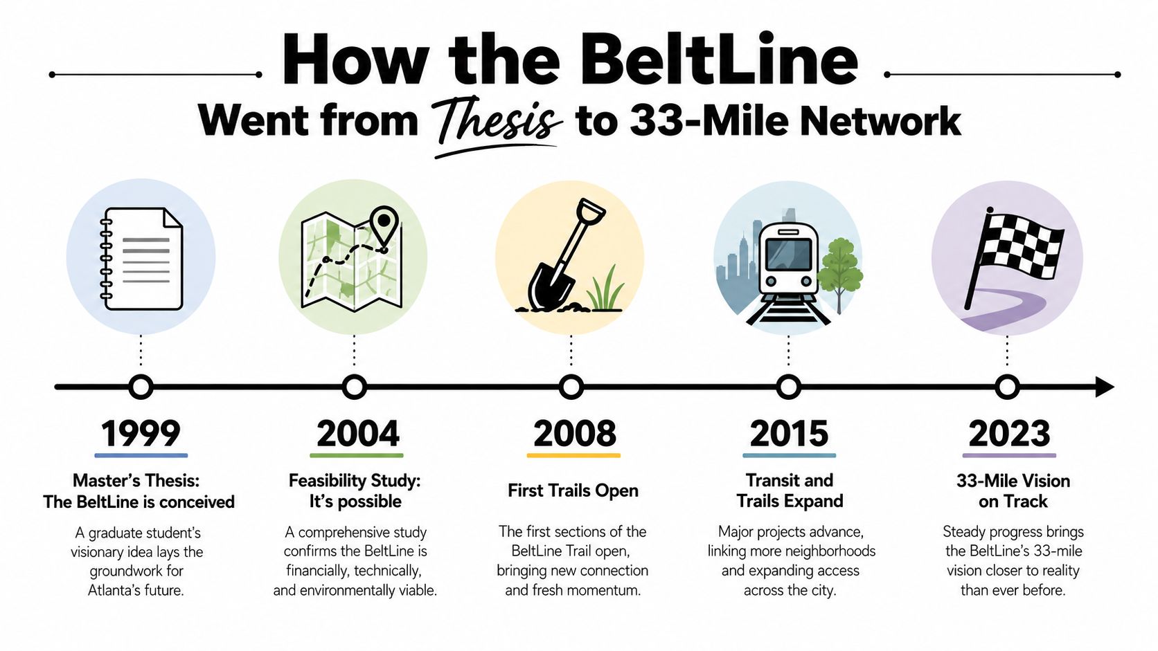
The BeltLine began with a transportation and land-use idea, not a restaurant district. In Ryan Gravel's 1999 Georgia Tech thesis, the concept imagined transforming a ring of underused rail corridors into a connected system of transit, trails, and parks. The proposal linked mobility with public space and neighborhood investment, giving Atlanta a framework for thinking about growth around a shared corridor. Atlanta BeltLine's history traces that evolution from an academic vision into a formal redevelopment effort.
The institutional step arrived in December 2005, when Atlanta Public Schools, Fulton County, and the Atlanta City Council approved the redevelopment plan and created the BeltLine Tax Allocation District. That financing mechanism helped support land acquisition, construction, and related redevelopment work. It also changed the project's status. The BeltLine was no longer only a compelling urban design proposal. It had become a public project with a long implementation horizon.
Why construction happens in phases
The project's phased form makes sense once you look beyond the map. Each segment can involve different landowners, environmental conditions, bridge structures, rail agreements, street crossings, utility conflicts, and funding schedules. A completed trail mile in one neighborhood doesn't automatically make the next mile ready for paving.
Georgia DOT's project presentation documents early openings that included West End Trail Phase I in October 2008, Northside Trail in April 2010, and West End Trail Phase II in June 2010. These milestones show why the BeltLine can feel both established and unfinished at the same time. Popular pieces opened while other parts remained under planning, design, construction, or street-based connection.
The broader project also grew to include brownfield reuse, park delivery, affordable housing, public art, and transit planning. Federal documentation describes the BeltLine as a redevelopment platform that connects former freight corridors with trail construction, parkland, and environmental remediation. That combination explains why the BeltLine matters to urban planners as well as visitors.
The project's history also creates a responsibility for users. New trails can improve access and encourage business activity, but investment can increase housing pressure for residents who have lived near the corridor for years. A thoughtful guide has to hold both realities together, the pleasure of using a new public space and the question of who can continue to afford the surrounding neighborhoods.
Understanding the Trail by the Numbers
The BeltLine's headline figure can confuse first-time visitors. The planned system includes a 22-mile main loop and additional connector trails that expand the overall network to 33 miles, designed to connect 45 neighborhoods. Those figures describe the long-term network, not 33 uninterrupted miles of completed, off-road trail.
By 2024, Atlanta BeltLine, Inc. reported 16.7 continuous mainline trail miles and 10.3 miles of connector trails open. A June 2026 project update again identified 16.7 continuous mainline miles, with 4.7 miles remaining for completion of the planned mainline loop by 2030, a projected target year cited by the project. The Atlanta BeltLine milestone update provides the current completion context.
Earlier federal documentation reported that, by 2017, 11 miles of paved trail had been completed, 307 acres of parkland had opened, and 396 acres of brownfields had been remediated. Those figures belong to that reporting period, so they shouldn't be treated as a current trail inventory. They do show that the project has always involved more than paving.
| Measure | What It Means | Planning Note |
|---|---|---|
| 22-mile loop | The planned mainline BeltLine corridor | Don't assume the entire loop is continuously trail-ready |
| 33-mile network | The planned loop plus connector trails | Use segment maps to identify actual open routes |
| 45 neighborhoods | The intended geographic reach of the system | Access and trail character vary by neighborhood |
| 16.7 continuous mainline miles | Mainline trail open in the latest cited project update | Confirm closures and detours before departure |
| 10.3 connector miles | Additional open connector trails reported with the mainline mileage | Connectors may serve different trip purposes than the loop |
| 22 miles of transit planning | The intended transit corridor alongside the trail system | Transit is a long-term infrastructure component, not a completed trail feature |
Surface, shade, grade, lighting, street crossings, restrooms, and nearby food options can change from one segment to another. Compare those practical details, not just mileage, before choosing a route. The federal overview of the Atlanta BeltLine project is useful for understanding the relationship between trails, transit, parks, and redevelopment.
Segment-by-Segment Map of What Is Open Today
The easiest way to orient yourself is to think from east to west, then treat northern trails as separate neighborhood connectors. The Eastside Trail is the most obvious choice for visitors who want restaurants, murals, parks, and a lively pedestrian atmosphere. Access around Piedmont Park, the Old Fourth Ward, Inman Park, and Reynoldstown gives you several ways to shorten or extend an outing.
The Eastside surface is generally suited to walking, running, rolling, and cycling, but the busiest areas require patience. Crowds, crossings, ramps, and nearby event activity can change the experience quickly. Krog Street Market and the surrounding Inman Park area work well as a destination or turnaround, while MARTA connections near Inman Park and Reynoldstown can support a one-way trip.
| Segment | Neighborhoods and Character | Access and Connections | Planning Note |
|---|---|---|---|
| Eastside Trail | Piedmont Park, Midtown, Old Fourth Ward, Inman Park, Reynoldstown. Lively, art-focused, and destination-rich | Park access, neighborhood streets, nearby MARTA connections, and Krog Street area | Expect crowds and frequent pauses, especially around popular destinations |
| Westside Trail | Bankhead, West End, Adair Park, and Southwest Atlanta. Longer green stretches and a more spacious feel | Access varies by trailhead, with West End and Bankhead connections useful for transit planning | Check the route carefully because a west-to-east day may require a street transfer |
| Northeast Trail | Neighborhood-scale connections near Ansley Park and adjacent northern areas | Local streets, nearby commercial destinations, and trail access points | It's better for a focused neighborhood outing than an attempt to complete the full loop |
| Northwest Trail | West Midtown and nearby northern neighborhoods, with dining and commercial activity | Local access points and street connections | Pair the trail with a specific restaurant or destination, and verify the open route |
| Southwest and Southside connections | Adair Park, Capitol View, and southern neighborhoods with community-scale destinations | Trailheads and local streets vary, so map the approach before arriving | Allow extra planning time for gaps, amenities, and return transportation |
Choose by character
The Eastside works when you want energy and visual variety. The Westside is a stronger fit for a calmer ride or walk with more room to breathe. Northern trails can be convenient for locals who want a shorter outing close to home, while southern and southwestern connections reward visitors who plan around a particular neighborhood destination.
The BeltLine's official maps remain the authority for current closures and construction. Don't rely on an old screenshot or assume a planned connection has opened because it appears on a promotional map.
Walking, Biking, and Transit on the BeltLine
Your mode should determine your route, not the other way around. A walker can stop frequently and turn around near a park or restaurant. A cyclist covers more ground but needs to account for crowding, path etiquette, bike availability, and the fact that unfinished connections can interrupt a through-route.
Walking and running
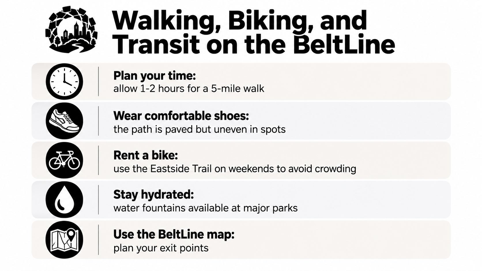
Walkers should pick an endpoint before starting. That simple decision helps you budget time for photographs, public art, food, restroom breaks, and unexpected congestion. Runners should identify water access and a turnaround point rather than assuming the trail supports an uninterrupted long-distance workout.
Wear shoes that can handle paved surfaces, ramps, and uneven spots. Stay to the right, pass with care, and step aside when stopping so other users can move through.
Cycling
Cyclists should slow down near crowded sections, obey path markings, and announce passes with a bell or voice. Casual riders may prefer the Eastside Trail at a quieter time, while commuters should study street connections and closures before treating the BeltLine as a transportation route.
If you're choosing a road or gravel bike for a mixed urban outing, these road and gravel bike sizing tips can help you compare fit considerations before renting or buying. A comfortable setup matters when a route includes both trail riding and short street segments.
Transit and rentals
MARTA can make a one-way itinerary practical. Stations including King Memorial, Inman Park/Reynoldstown, Bankhead, and West End may support BeltLine trips, but the station won't always sit directly beside the trailhead. Check the walking connection before committing to a departure point.
Bike-share stations, rental operators, and scooters can help with partial trips, but availability, account requirements, parking zones, and coverage can change. Confirm those details in the relevant app before you leave. For a broader look at Atlanta's mobility, see this overview of transportation technology and smart mobility in Atlanta.
Bring water, plan your exit, and identify a food or restroom stop before the route begins. The BeltLine works best when you treat it as an urban trip, not a sealed recreational loop.
Itineraries You Can Actually Use
A good BeltLine itinerary has a clear shape. You need a start point, a destination, a return plan, and enough flexibility for food, art, crowds, and route gaps. These four options cover different kinds of days without pretending one route suits everyone.
| Itinerary | Best For | Suggested Shape | Main Tradeoff |
|---|---|---|---|
| Eastside half-day | First-time visitors and casual walkers | Begin near Piedmont Park, follow the Eastside Trail, stop in the Old Fourth Ward and Inman Park, finish near Krog Street Market, then return by transit | High activity and crowds can slow the route |
| Cross-city full day | Visitors who want a broader view of the project | Combine an eastside outing with the Westside Trail, using transit or a planned street transfer between areas | Requires more navigation and advance closure checks |
| Family outing | Parents, children, and stroller users | Choose a shorter park-centered segment with lawns, restrooms, food, and a simple return route | You'll cover less trail, but the day will be easier to manage |
| Active ride or run | Experienced cyclists and runners | Select a longer open segment, add planned intervals or stops, and finish near transit or a known pickup point | More distance increases the impact of heat, shade, water, and route gaps |
A practical half-day
The eastside route is the safest default for a first visit because attractions are close together. Start near Piedmont Park, move through the Eastside Trail, pause for art and neighborhood views, and use Krog Street Market as the meal destination. You can shorten the outing without losing the central experience.
A fuller exploration
A full-day plan can pair the Eastside and Westside, but don't draw a straight line across the map and assume the trail will carry you there. Use MARTA, a rideshare, a bike, or a carefully checked street connection between segments. This itinerary gives you a more balanced view of the BeltLine's different neighborhoods, but it demands more attention to navigation.
Families and active users
Families should prioritize dependable access to restrooms, food, shade, open lawns, and an easy return. Confirm stroller and wheelchair conditions at the chosen trailhead before leaving, especially if a route includes a transition away from the main paved path.
Active riders and runners can build a longer outing around one continuous open segment. Save energy for the return, and don't treat a planned mileage figure as completed trail. Local event timing can transform a route from relaxed to crowded, so check Atlanta events and weekend activities before choosing your start time.
Safety, Accessibility, and Local Impact
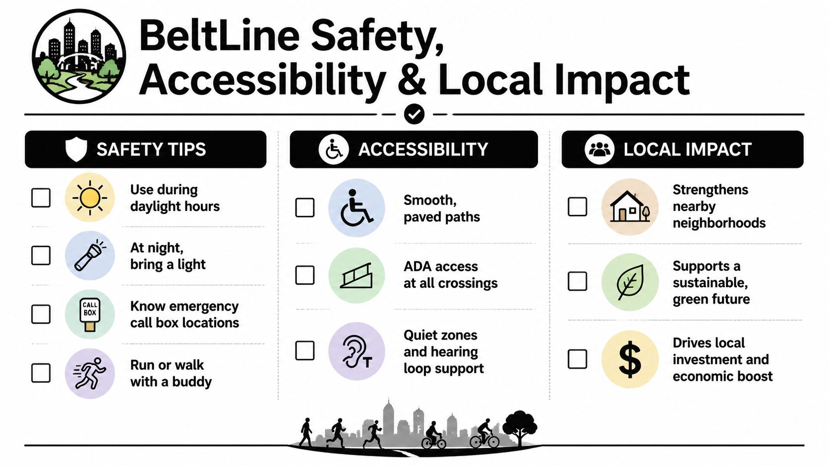
Suppose you finish dinner near the BeltLine and decide to walk one more segment after sunset. The route may look familiar, yet lower light changes how easily you can read signs, spot surface changes, judge crossings, and find a business or transit connection. Learn a new segment in daylight first. At night, choose a shorter route with a clear exit instead of assuming a busy daytime path will feel identical after dark.
Atlanta public safety guidance directs users to call 911 for suspicious activity. Digital wayfinding kiosks are being installed, but they are turned off from 12:00 AM to 5:00 AM and do not include an emergency button, as noted in the official BeltLine visitor information. Carry a charged phone and personal light, and decide in advance where you will leave the trail. During those hours, kiosk navigation will not be available.
Accessibility requires route-level planning
A paved trail is only one part of an accessible outing. The approach to the trailhead, grade changes, ramps, surface transitions, curb cuts, construction barriers, crossings, restrooms, and nearby destinations can produce very different conditions for wheelchair users, people with limited mobility, and families with strollers.
Check the exact trailhead and destination before leaving. If someone in your group needs a predictable surface or accessible restroom, build the itinerary around confirmed facilities. A segment's reputation cannot answer those practical questions.
Growth creates both benefits and pressure
BeltLine investment has brought trails, parks, environmental remediation, and links among neighborhoods. It has also increased development pressure near the corridor. Atlanta BeltLine, Inc. reports that 4,425 affordable housing units have been created, preserved, or are actively being built, representing 79% of its 5,600-unit affordable housing goal for 2030. Its affordable housing update also recognizes the continuing challenge of affordability and displacement. Readers tracking that relationship can review these Atlanta real estate market trends and home prices.
Local impact also includes what businesses and residents discard. Reworx Recycling handles business pickups, equipment decommissioning, secure hard-drive shredding, and electronics recycling for Atlanta-area organizations retiring technology, keeping old computers and devices out of ordinary waste streams.
BeltLine-adjacent construction teams can use this guide for eco-friendly building teams to plan material responsibility and construction waste. The same habit works for a home-office cleanout. Old laptops and devices need a documented, responsible end-of-life path.
Planning Toolkit and Resources
A smooth BeltLine day starts with current information. Use the official interactive map and downloadable segment maps to confirm where the trail is open, where a connection changes to a street, and which access point fits your itinerary. Save the map before leaving, especially if you're visiting from outside Atlanta and don't want your route to depend on a strong mobile signal.
MARTA rail and bus maps help you match trailheads with transit. The Atlanta Bicycle Coalition can add route-safety context for cyclists, while the BeltLine Partnership events calendar can help you identify recurring activities such as the Lantern Parade and Atlanta Streets Alive. Events can make a route more vibrant, but they can also affect crowd levels, parking, and travel time.
| Resource | Best For | Access |
|---|---|---|
| Atlanta BeltLine interactive map | Current route orientation and access points | Official BeltLine website |
| Downloadable segment maps | Offline planning and route comparison | Official BeltLine website |
| MARTA rail and bus maps | Matching trailheads with transit | MARTA website and stations |
| Atlanta Bicycle Coalition materials | Cycling safety and street-route preparation | Atlanta Bicycle Coalition website |
| BeltLine Partnership events calendar | Festivals, public programs, and recurring events | BeltLine Partnership website |
| Bike and scooter apps | Rental availability and service zones | Provider apps before departure |
| Weather and air-quality alerts | Heat, storms, and outdoor comfort decisions | Local weather and air-quality apps |
If you're flying into Atlanta, plan the airport transfer separately from the trail route. The BeltLine doesn't replace airport transportation, and your best trailhead may require a connection after arriving. This guide to Atlanta Hartsfield-Jackson transportation can help you think through that first leg.
Pick one itinerary from this guide, bookmark the official map and the relevant MARTA map, then check the events calendar for the upcoming weekend. That small preparation step will give you a route with a clear start, a realistic endpoint, and fewer surprises.
Reworx Recycling helps Atlanta-area businesses manage electronics recycling, IT equipment disposal, secure data destruction, office cleanouts, and responsible technology donations. If your organization near the BeltLine is retiring laptops, servers, medical equipment, or other electronics, visit Reworx Recycling to explore pickup scheduling and partnership options.